Showing posts with label photo collage. Show all posts

Friday, July 5, 2013

Kolob Canyons, Zion National Park (or the end of a journey)


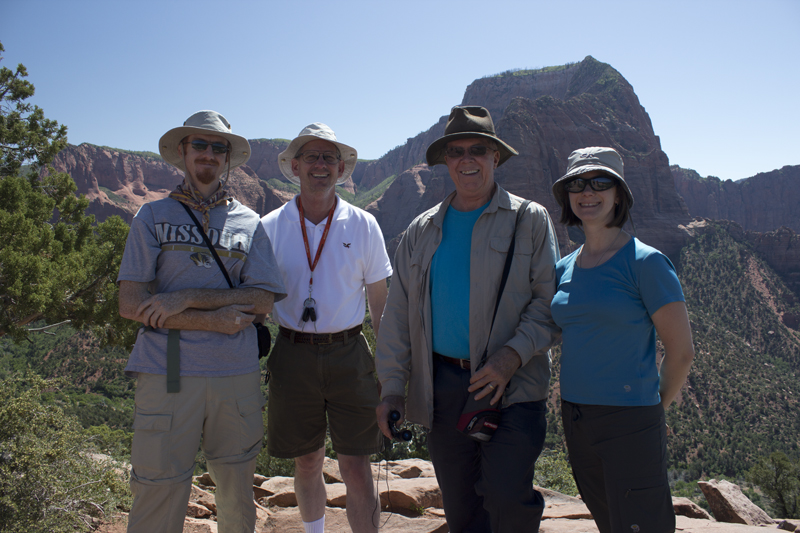
Somehow, I overlooked finishing my posts of photos from last year's summer vacation. Well, here it is... the long-awaited end to the summer journey of 2012 with my father, father-in-law, and husband. We spent our last morning before the long drive home out at Kolob Canyons in Zion National Park. Though this was my third visit to this wonderful park, it was the first time I'd been to this area. It was beautiful and we did a nice 1 mile hike to the Timber Creek Overlook, with 360 degree views at the end.


This concludes a series on our 2012 trip. In case you missed them, here are my previous posts:
All photos copyright Katrina Kouba Boles

Sunday, November 25, 2012

Zion: A three-year tradition

Yes, I have been very slow going through all the photos from this year's vacation. How did it get to be late November and I'm still going through pictures from May, I don't know. Anyway, so lets get back to that, shall we?

At the end of our trip, we opted to tack on a small detour to Zion, but first we had to drive there which can be quite pretty:
 Vermillion Cliffs
Glen Canyon Bridge & Dam

Surprisingly, after four days in the Grand Canyon and the hiking intensity, we were amazed at how another 5 mile hike with a 1400+ ft elevation change felt good rather than painful. On our first trip to Zion, Mike and I had to work up to the Angel's Landing hike and last year's trip we tried the Observation Point trail in Zion. Since it was a first trip to Zion for both our dads, we opted for the Angel's Landing hike again. Rather than talk about it, I'll just share some photos and a timelapse from the top:
 Walter's Wiggles
 Looking up to Angel's Landing
 Climbing Chains

Zion Timelapse 20120527 from Katrina Kouba on Vimeo.


Next: Kolob Canyons, Zion National Park

This is a series on our 2012 trip. In case you missed them, here are my previous posts:
All photos copyright Katrina Kouba Boles

Monday, August 13, 2012

Final Day in the Grand Canyon

I realized recently that there was something I left out of my previous post... Walking the 1.5 miles from Plateau Point to the Indian Gardens campground after sunset it's almost pitch black out as you enter the campground. As you cross the creek, the crickets and frogs create a symphony of music which I stopped to capture on my phone. Perhaps I'll use it as a backdrop for a video in the future.

We could not have asked for a more perfect day hiking out of the Grand Canyon. It must've been in the 70s at Indian Gardens when we started out. The clouds and haze kept the North Rim almost invisible. The wonderful weather made for a good restful night of sleep, so I was ready for the hike. And it was a great hike! The first time we did this hike - six years ago - this was the worst day for me. Fortunately, we didn't have the weather to contend with and I was in much better shape.

By the time we were on the last couple of miles, where almost everyone who comes to the canyon and decides to hike just a bit crowd the trail, we were seeing people in down coats and hats as if it were snowing at the top. When we reached the top, we knew why. The wind was whipping right through us and we found ourselves quickly heading for the car for warmer clothes! Didn't expect that!

One would think we might skip our ice cream tradition, but you can't mess with tradition! So there we sat, shivering and eating ice cream.


Next Up: Zion, Our Three Year Tradition

This is a series on our 2012 trip. In case you missed them, here are my previous posts:
All photos copyright Katrina Kouba Boles

Wednesday, June 27, 2012

Rockin' the Bottom: Phantom Ranch Part 1

sunburst on Battleship rock in "The Box," North Kaibab Trail
The Grand Canyon... what an awesome place! Backpacking it makes you forget all the troubles and worries of the working world, allowing you to dwell in the moment (particularly on your aching legs and sore knees). Fortunately, when you spend a day at the bottom, you get to enjoy a little of it's splendor without the constrains of carrying all your belongings and mentally reminding yourself over and over "you can do it".

So what exactly is it like at the bottom of the canyon? Rightly, I can't honestly describe it and my pictures/video don't do it justice. That does not mean I did not try to capture it as you will soon see, it just means that no camera can put you there... in that immense space that strangely feels so small, with towering peaks deceiving your well-tuned depth perception, particularly when you realize you can't even see the rim from which you came.

With what did we fill our day at the bottom? We had breakfast at Phantom Ranch. Then, leaving most of our belongings at our campsite, we did a morning walk about 1.5 miles through "the box" on the North Kaibab Trail. Compared to the day before, it was a flat hike that followed the Bright Angel Creek. It's recommended that you make your way through the box before mid-day as the towering walls of the canyon are like an oven that gradually heats during the day and is stiflingly hot from afternoon through evening. Headed North it was mostly shady and we turned back when it looked like shade would be hard to find up ahead.
 testing my slow shutter on the Bright Angel Creek
 (Once I figure out how, I will add a button to enable buying prints of these puzzle/collage photos via Fotomoto)

2 photos morphed together and made HDR
 having fun with HDR and layering photos, created in Photoshop

Up Next: The Sky in the Grand Canyon - Phantom Ranch Part 2

This is a series on our 2012 trip. In case you missed them, here are my previous posts:
All photos copyright Katrina Kouba Boles

Tuesday, June 19, 2012

The Grand Canyon, Going Down is Optional

The guys admiring the view at Ooh Aah Point - seriously I didn't pose them 
and I didn't name the location either

Our descent into the Grand Canyon via the South Kaibab Trail was... well... let's just call it rough. Lest this be misconstrued as complaining, I'll start off by saying that it's all totally worth it! Exhibit A:
You can actually see where we took the picture of all of us in this collage - that hump on the second picture from the left is the same hump in the background of the previous picture.
The South Kaibab trail is not for the faint of heart. It's hot. The blistery wind whips up the red dust and brushes it like sandpaper against your skin. Almost no shade and no water add to the delights of the almost constant decline of the path. I took precautions for all of these things: carrying at least 4 liters of water, wearing long pants, long-sleeve shirt, and bandana around the neck to safeguard my face through the dust storms, and training by hiking the 9 story parking garage for weeks before the inevitable. However, the almost constant strain on my knees (I wore braces the whole time) and constantly tightening my boots to prevent my toes slipping into the front of my boots over and over again, coupled with my own problem of not drinking quite enough - the bathrooms are too far apart - made it my least favorite day. The phrase "it's all uphill from here" really fit for me.

 A Century Plant (only blooms once just before it dies) 
I literally had my arms raised all the way as I was standing on a rock to get this picture
 I don't know how tall these things get, but this one was easily 2X my height. Fortunately it was bending over so I could get under it to take this photo.

Fortunately, amazing views the whole route and the exciting prospect of a wonderful stew meal at the bottom got me through. (Last time we did this - six years ago - the hike down wasn't so bad, except for the last mile that Mike and I ran - yes literally ran with a 30-40 lb backpack - to get to the ranch in time for dinner, but the struggle getting out was so much worse for me as a result. Also, it actually rained on us in 2006 and the cloud cover made it more bearable.) At any rate, we did this trail in record time - for us - with my dad always the first to get our butts moving after a break, and an overwhelming urge to get out of the heat, I think it only took us like 5-6 hours!

Not quite a 360 ° panorama (click on the image to enlarge it)

The fact that we made it to the campground in the early afternoon turned out to be a really REALLY good thing. We were too late for the best campsites, but we got there before the second break in the water line washed away a good portion of the trail. Had we arrived later, we would've had to backtrack and come around a different - longer - way. The breaks in the water line did affect us. Those who were staying at the ranch were more inconvenienced in that their promised showers were taken away. As it was, there was only one place to get fresh drinking water and all flush toilets required carrying a bucket full of creek water into the restroom with you and pouring that into the toilet to get it to flush.

 Our first view of the Colorado River - probably a little more than half-way to the bottom!

All meals were still served and fun was still had. After a delicious stew meal where we met new friends and shared tales of journeys had and yet to have, we went to a ranger talk about the geology of grand canyon - Grand Canyon ROCKS! - and then attempted to sleep in our hot tents as the wind pushed the dust through the screens. Those who did get to sleep woke up covered in a thin layer of red sand. I, however, was glad to have a view of the moon and stars as I lay awake wondering if it would ever cool off enough to get to sleep.

Next up: A Day at the Bottom!

This is a series on our 2012 trip. In case you missed it, here is my first post:
All photos copyright Katrina Kouba Boles

Thursday, June 14, 2012

Petroglyphs and Painted Desert

What might two dads and their eldest (adult) kids do after driving 1000+ miles to Albuquerque, before finishing their drive to Grand Canyon? Hint: playing in the waterpark at their hotel is not the correct answer. Answer: they decided to take a scenic detour at Petroglyph National Monument near Albuquerque.

Yes! One more stamp in my national parks passport! Supposedly there were like 100 petroglyphs on the Mesa Point Trail in Boca Negra Canyon. I think we probably missed a few. One thing we didn't miss were the views of Albuquerque. On such a beautiful day, it was a great little diversion. It was a short, easy trek up to viewpoints into the canyon on one side and Albuquerque on the other. And, though we didn't have it to ourselves, we only saw a handful of other visitors.

We also veered off the highway a bit at Petrified Forest National Park. But since we spent all our "free time" at Petroglyph NM, we opted not to drive the 26 miles out of our way to see the "forest". We did take a little stroll at the Painted Desert, where it was just as windy as I remember it from last time.


This is the first in a series of posts on my 2012 travels. Up next: Hiking the Grand Canyon

All photos copyright Katrina Kouba Boles

Tuesday, September 6, 2011

Bryce Canyon, NP, Utah

After taking the Observation Point trail too quickly on our way back to camp the day before, hiking in Bryce Canyon was a challenge. But here's the thing: typically I like to hike up first and down on the way back, but when you're hiking into a canyon it just doesn't work that way. Yet, after such a hike, it was painful hiking into the Bryce amphitheater (it's not really a canyon), and coming out was much much easier!

We've finally learned our lesson about paying for more than one day at a campsite, and though we'd planned to spend two nights in Bryce, we paid only for one in case we changed our minds - which we did. Anyway, after we found the spot we wanted at the sunset campground, we walked up to catch the bus out to Bryce Point.
 Bryce Point, Elevation 8300 ft
The plan was to take the Peek-a-Boo trail to the Navajo trail and come out through wall street at the sunset point parking lot. The Peek-a-Boo trail took us down into the amphitheater, through arches and switchbacks.


As we descended, there were numerous panoramic moments.


Once we were at the bottom, most views were hindered by trees and "dead" hoodoos. However, wall street (two really tall fins that haven't yet eroded into arches or hoodoos) was pretty cool.


We were lucky I guess. Last year we hiked the Navajo to the Queen's Garden loop, and since the wall street side of Navajo was closed, we went down the thors hammer side. This year, the opposite was true: thors hammer was closed so we got to do the wall street side. Amazingly, I made it up the 20+ switchbacks out of wall street with only one short stop in the middle. I guess I was pacing myself and had gained some muscle endurance on all our other hikes this trip.

The next morning we got up early to see the sunrise from sunrise point. 

Though we should've been prepared, we didn't expect it to be as cold as it was. One hour of waiting and watching, then we packed up our campsite and drove to see the south end of the park before heading to Colorado.

Here marks the end of our national parks tour for this trip. We loved the beautiful sights we got to enjoy and I've really had fun making all the collaged photos and little planets. The last days of our trip were spent driving and a two-day stopover in Boulder, CO. There, we relaxed, went to a movie, and I spent some time in the Butterfly Pavilion, which was awesome! So, stay tuned...

Photos copyright Katrina Kouba Boles

This is a series on our 2011 trip. Here are the previous posts:

Tuesday, August 16, 2011

Hiking to Observation Point, Zion NP, Utah

While last year we really loved hiking to Angel's Landing, we decided with only one full day in Zion, that perhaps we ought to do another trail with spectacular vista views. Of course, we opted for a harder trail than last year.

Sidenote: last year Zion was one of the last parks we visited, knowing that we'd want to attempt the nearly 5-mile and 1488 ft ascension to the peak, and worked up our stamina to be able to do it. I guess I figured since we managed the 7-mile and 1100 ft ascension at Harney Peak merely days before, that we'd be fine doing a harder and longer trail.

The trail to Observation Point begins at the Weeping Wall trail-head and it starts climbing almost immediately. This trail is an 8-mile round-trip with a 2147 ft ascension and is not for those who are afraid of heights. However it's almost entirely paved and switchbacks make it do-able.
It begins with a series of switchbacks that quickly lead you up the side of the rock-face,  producing more and more beautiful views at every turn.
This is the last view of the main canyon for a while as the trail bends southeast into Echo Canyon. Having done little research for this particular trip to Zion, I did not realize that the canyon would narrow into a slot canyon, delving 20ft down a very narrow passageway. Frankly, this was one of our favorite parts of this hike. Maybe because it was unexpected?

Once you leave the narrow section of Echo Canyon, the trail begins ascending again up the north side of Echo Canyon and the views are of the primarily white canyon walls where trees and shrubs precariously grow, providing little shade in this arid and bright landscape.
(This photo was actually taken on our way back, but I wanted to show the trail etched into the cliff.)

Relief from the climb came in the last mile or so to observation point. It was mostly flat and occasionally provided some shade. There were several times where the view seemed spectacular enough to stop and head back, but then the trail led into an area of brush where the view is less interesting, and suddenly out of the brush and voila: 270 degree panoramic views.
Mike had fun pulling out his binoculars to see if he could spot people on Angel's Landing, which seemed a lot higher up when we were there last year - and a LOT more crowded. That place would've looked like an ant hill with the swarms of people. This year we saw very few over there.

So it took us about 3 hours to hike to Observation Point, we spent an hour at the point, just soaking in all the views (thankfully my camera also did some soaking so my brain would not have to remember it all), and then the two hour hike back down would inevitably come back to haunt us the next day.

We were too tired to cook, so in the name of a new tradition, we went back to have pizza at Springdale's Pizza and Noodles restaurant where we could sit outside and enjoy our food.

Feel free to comment. If you've been to Zion, I'd love to know what you saw and if you'd recommend other hikes. Though I have a hard time wanting to go back to parks I've already seen - there are just so many and I want to see them ALL - I could go back to Zion. It's so beautiful.

Photos copyright Katrina Kouba Boles

Next up: Bryce Canyon NP, Utah

This is a series on our 2011 trip. Here are the previous posts: